Companion Piece: Spin & Find Facilitation Guide
Teaching Earth's Systems
Proof that the game is a curriculum, not a toy
NOTE
Original portfolio sample, a teacher facilitation guide for my interactive game "Spin & Find." Created to demonstrate curriculum-design capability. Not affiliated with or produced for any employer or institution.
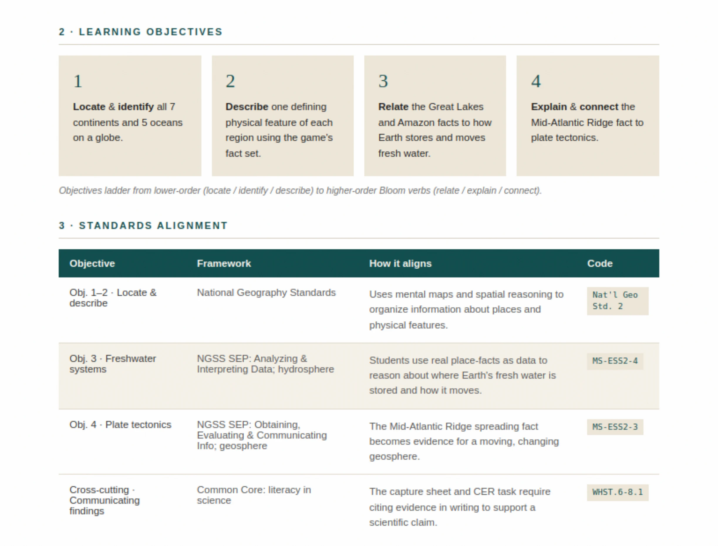
THE DELIVERABLE
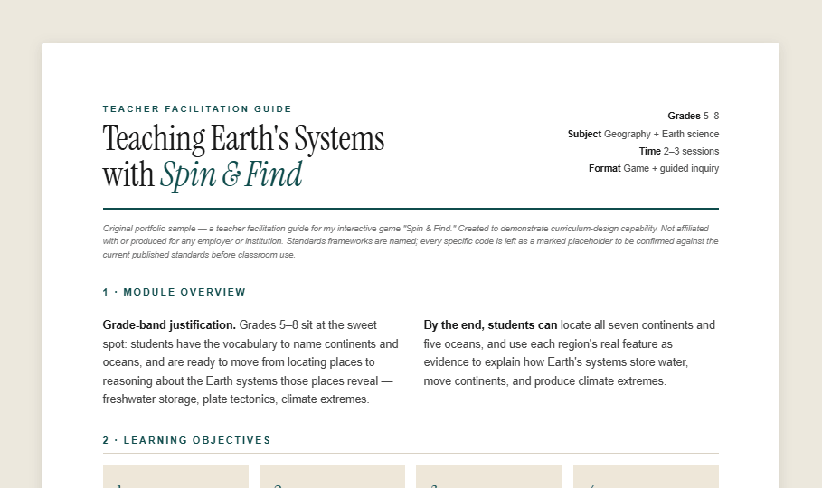
A print-ready facilitation guide. Module overview, objectives, standards table, learning-science rationale, a runnable lesson flow, student capture sheet, CER assessment, and misconception notes on letter-size pages a teacher can run from directly. The case study below unpacks the curriculum decisions.
1. MODULE OVERVIEW
Grade-band justification. Grades 5–8 sit at the sweet spot: students have the geographic vocabulary to name continents and oceans, and are ready to move from locating places to reasoning about the Earth systems those places reveal. Freshwater storage, plate tectonics, climate extremes.
- Standards alignment mapped to the game mechanics, not bolted on
- A complete lesson flow, from launch to closure
- Differentiation and accessibility built into every activity
By the end, students can locate all seven continents and five oceans, and use each region's real feature as evidence to explain how Earth's systems store water, move continents, and produce climate extremes.
2. LEARNING OBJECTIVES
Locate and identify all 7 continents and 5 oceans on a globe (geographic literacy).
Describe one defining physical feature of each region using the game's fact set.
Relate the Great Lakes and Amazon facts to how Earth stores and moves fresh water (hydrosphere).
Explain and connect the Mid-Atlantic Ridge fact to plate tectonics, a changing geosphere.
3. STANDARDS ALIGNMENT
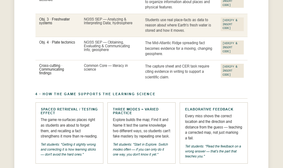
Frameworks and specific codes are named in the guide's standards table; as with any curriculum sample, verify against the current published standards before classroom use.
4. HOW THE GAME SUPPORTS THE LEARNING SCIENCE
The game re-surfaces places right as students are about to forget them, and recalling a fact strengthens it more than re-reading it.
Tell students: "Getting it slightly wrong and correcting it is how the learning sticks. Don't avoid the hard ones."
Explore builds the map; Find It and Name It test the same knowledge two different ways, so students can't fake mastery by repeating one task.
Tell students: "Start in Explore. Switch modes often, if you can only do it one way, you don't know it yet."
5. LESSON FLOW
Open with a question that turns place-naming into science: "Where is Earth's fresh water actually stored?" Students guess, then meet three clues from the game's fact set. Antarctica holds ~70% of Earth's fresh water as ice up to ~4.8 km thick; North America's Great Lakes hold ~21% of the surface fresh water in five connected basins; the Amazon carries about a fifth of all river water reaching the oceans. The hook reframes the globe as an Earth-systems dataset, not a name-memorization chore.
Students play Explore mode first (5–8 min) to build the mental map, then move to Find It and Name It for retrieval practice. Run individually for the first pass, then in pairs so students explain their reasoning aloud. The teacher monitors the Mastery Map to see which regions the class is missing and pulls the group back together to address common gaps.
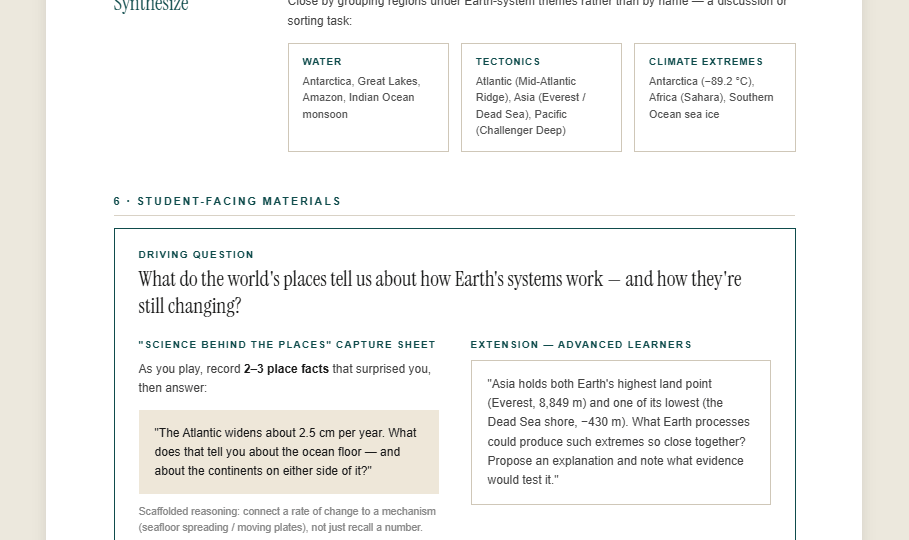
Close by grouping regions under Earth-system themes rather than by name, a discussion or sorting task:
Antarctica, Great Lakes, Amazon, Indian Ocean monsoon
6. STUDENT-FACING MATERIALS, EXCERPT
What do the world's places tell us about how Earth's systems work, and how they're still changing?
As you play, record 2–3 place facts that surprised you, then answer:
"The Atlantic widens about 2.5 cm per year. What does that tell you about the ocean floor, and about the continents on either side of it?"
Scaffolded reasoning: students connect a rate of change to a mechanism (seafloor spreading / moving plates), not just recall a number.
7. ASSESSMENT
"Name one continent or ocean and the Earth system its main feature belongs to (water, tectonics, or climate), and say why." Directly checks Objectives 3–4.
"Which continent's or ocean's feature best shows Earth's systems changing over time? Make a claim, support it with evidence from the game's facts, and explain your reasoning."
8. DIFFERENTIATION & ACCESSIBILITY
Provide the fact set as a picture-and-phrase reference card; pre-fill the capture sheet's first row as a model. Use Explore mode longer before graded modes.
Assign the Asia-extremes extension and Streak mode; ask them to add a region to one of the Earth-system groups and defend it.
The game is fully usable keyboard-only and by screen-reader users. Live audio announcements read out prompts, results, and the same direction-and-distance feedback sighted players see, and a reduced-motion option stops the globe from spinning. Pair a screen-reader user with a partner for the map-sorting discussion, not for the gameplay itself. They can play independently.
9. FACILITATOR TIPS & MISCONCEPTIONS
Clarify: the Southern Ocean was officially recognized as the fifth ocean in 2021, ringing Antarctica. A good example that science classifications get updated.
Use the Atlantic's ~2.5 cm/year widening as concrete evidence that plates, and the continents on them, are moving right now, just slowly.
The synthesis grouping shows features cross the land/water line, the Mid-Atlantic Ridge is under an ocean but is a tectonic story shared with the continents.
Reframe Antarctica as Earth's largest freshwater reservoir: ~70% of the planet's fresh water, locked as ice.
From the work
Objectives to assessment in one printable kit. Proof that the game is a curriculum, not a toy.